Petrol pump, near Rampur
Not yet checked1 km from Rampur.
From the open map · read 6 October 2026 · no rider has confirmed it
Basic page · 41 facts
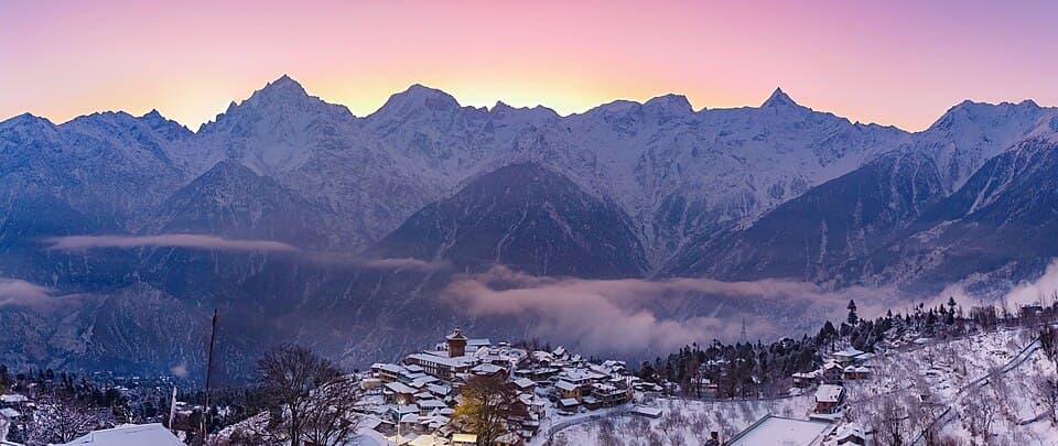
Himachal Pradesh, up the Sutlej on the old Hindustan-Tibet road, then the Baspa valley to Chitkul
1 km from Rampur.
From the open map · read 6 October 2026 · no rider has confirmed it
3 km from Rampur.
From the open map · read 6 October 2026 · no rider has confirmed it
4 km from Rampur.
From the open map · read 6 October 2026 · no rider has confirmed it
22 km from Rampur.
From the open map · read 6 October 2026 · no rider has confirmed it
29 km from Rampur.
From the open map · read 6 October 2026 · no rider has confirmed it
51 km from Rampur.
From the open map · read 6 October 2026 · no rider has confirmed it
Indian Oil. 94 km from Rampur.
From locator.iocl.com · read 6 October 2026 · no rider has confirmed it
HP. 172 km from Rampur.
From petrolpump.hpretail.in · read 6 October 2026 · no rider has confirmed it
212 km from Rampur.
From the open map · read 6 October 2026 · no rider has confirmed it
219 km from Rampur.
From the open map · read 6 October 2026 · no rider has confirmed it
221 km from Rampur.
From the open map · read 6 October 2026 · no rider has confirmed it
Indian citizens ride through with a photo identity card, shown at check posts. The district page asks every visitor to carry identity. No separate order was found.
No government order found · from discoverwithdheeraj.com · dated 22 August 2026 · read 28 September 2026 · no rider has confirmed it
Applies in Pooh block, beyond this route. A rider blog says Sangla, Chitkul and Kalpa need none. Kinnaur's page: groups of two, thirty days, Rs 200 each.
From hpkinnaur.nic.in · dated 5 September 2026 · read 28 September 2026 · no rider has confirmed it
Every visitor carries a valid identity card. Roads towards Shipki La and Kaurik are closed to visitors, and security installations may not be photographed.
From hpkinnaur.nic.in · dated 5 September 2026 · read 28 September 2026 · no rider has confirmed it
The road beyond Chitkul runs towards the border and is not open to visitors. Stated by an encyclopedia page; no order was found.
No government order found · from en.wikipedia.org · read 28 September 2026 · no rider has confirmed it
Charged at entry barriers under the yearly toll policy. Notified rates name passenger and goods vehicles only. The Chief Minister said two-wheelers stay exempt. The policy document was not opened.
From tribuneindia.com · dated 2 April 2026 · read 28 September 2026 · no rider has confirmed it
Repeated slides cut Kinnaur off from Shimla, once for about ten days. Debris keeps falling while crews work.
From tribuneindia.com · dated 7 October 2023 · read 28 September 2026 · no rider has confirmed it
A landslip broke the highway and stranded tourist vehicles and apple trucks on both sides.
From tribuneindia.com · dated 2 October 2024 · read 28 September 2026 · no rider has confirmed it
The village is mostly snow-covered in winter and residents move lower down.
From en.wikipedia.org · read 28 September 2026 · no rider has confirmed it
0 trip reports for Kinnaur: Sangla, Chitkul and Kalpa so far
0 trip reports for Kinnaur: Sangla, Chitkul and Kalpa so far
Ridden it? Send a trip report