6 km from Aut.
Jalori Pass, Tirthan valley and Shoja
75 facts
NH 305
97KM
Jalori Pass, Tirthan valley and Shoja
Himachal Pradesh, from the Beas at Aut up the Tirthan and Banjar valleys and over Jalori Pass to Anni
- Usual days
- 3 to 6
- Highest point
- 10,240 ft
- Usually open
- Mar to Jun
- No fuel for
- 79 km
No rider has checked these facts yet
Each one shows where it came from and when. Ridden it? Tap “Still true” on what you saw, or “This has changed”. How far to trust it
Before you leave
On this page
Fuel
3 pumpsAut0 kmAnni97 km79 km · no pumpBanjar19 km
From the open map, not yet checked
All 3 pumps were read from OpenStreetMap on 28 September 2026. No rider has confirmed any of them yet.
Cash: ATMs and banks
3 halts| Halt | ATMs | Banks |
|---|---|---|
| AutPunjab National Bank | 0 | 2 |
| BanjarHDFC Bank ATM, Punjab National Bank | 1 | 1 |
| AnniHDFC Bank ATM, ICICI Bank, Lok Miter Kender, Punjab National Bank - ATM, Punjab National Bank - CDM | 2 | 3 |
Listed on a public map (Overture Maps). An ATM on the map can be empty or out of order, and no rider has confirmed these yet.
Rules for motorcycles
3 factsDistrict notices bar trucks, tippers and dumpers on set days and hours to ease jams. Motorcycles and light vehicles are not named in the restriction.
From hpkullu.nic.in · dated 27 November 2025 · read 28 September 2026
After each snow closure the highway is reopened to four-wheel-drive vehicles first, then to others and buses. Reports do not mention motorcycles. No written order found.
No government order found · from tribuneindia.com · dated 9 February 2025 · read 28 September 2026
Charged at entry barriers under the yearly toll policy. Notified rates name passenger and goods vehicles only. The Chief Minister said two-wheelers stay exempt. The policy document was not opened.
From tribuneindia.com · dated 2 April 2026 · read 28 September 2026
Trouble on the road
4 warningsFrom published guides, not from riders
Each warning names the months it applies to. None has been seen by a rider this season unless it says so.
The pass shuts for days or weeks after snowfall and can close again within days of reopening.
From tribuneindia.com · dated 20 March 2024 · read 28 September 2026
A newspaper notes the pass road is also shut for days by landslides during the rains.
From tribuneindia.com · dated 20 March 2024 · read 28 September 2026
A local guide calls the road steep, narrow and winding, easiest in dry conditions.
From jibhi.in · dated 6 February 2026 · read 28 September 2026
From Aut to Jalori the highway is one lane, only about half re-tarred, with potholes. On autumn weekends traffic jams run from morning to late evening.
From amarujala.com · dated 9 October 2026 · read 15 October 2026
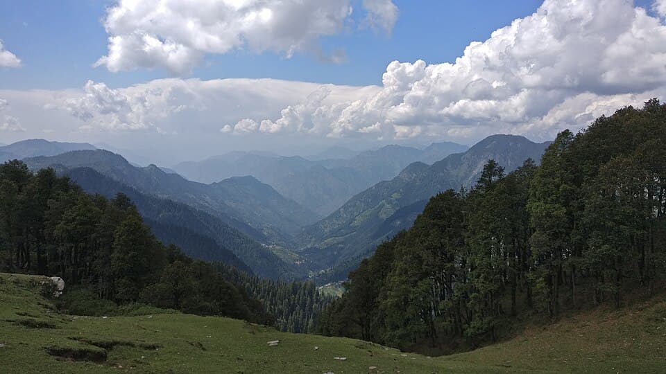
Recent photos near the road
1 photo
From Wikimedia Commons, the newest dated photo near each pass and high halt. A photo shows the road on the day it was taken, not today.
Stays
34 placesNot listed: Banjar (98 places on the map), Jibhi (72 places on the map), Gushaini (69 places on the map). This list is for the halts between, where rooms are few.
Hotel
From the open map · dated 22 October 2026 · read 8 November 2026
Homestay
From the open map · dated 22 October 2026 · read 8 November 2026
Resort
From the open map · dated 22 October 2026 · read 8 November 2026
Cottage, 2.6 km off the road
From the open map · dated 22 October 2026 · read 8 November 2026
Bed and breakfast
From the open map · dated 22 October 2026 · read 8 November 2026
Hotel
From the open map · dated 22 October 2026 · read 8 November 2026
Hotel
From the open map · dated 22 October 2026 · read 8 November 2026
Resort
From the open map · dated 22 October 2026 · read 8 November 2026
Hotel
From the open map · dated 22 October 2026 · read 8 November 2026
Campsite
From the open map · dated 22 October 2026 · read 8 November 2026
Hotel
From the open map · dated 22 October 2026 · read 8 November 2026
Hostel
From the open map · dated 22 October 2026 · read 8 November 2026
Campsite, 2.1 km off the road
From the open map · dated 22 October 2026 · read 8 November 2026
Cottage
From the open map · dated 22 October 2026 · read 8 November 2026
Hostel
From the open map · dated 22 October 2026 · read 8 November 2026
Homestay
From the open map · dated 22 October 2026 · read 8 November 2026
Hotel
From the open map · dated 22 October 2026 · read 8 November 2026
Hostel
From the open map · dated 22 October 2026 · read 8 November 2026
Homestay
From the open map · dated 22 October 2026 · read 8 November 2026
Cottage
From the open map · dated 22 October 2026 · read 8 November 2026
Homestay, 1.5 km off the road
From the open map · dated 22 October 2026 · read 8 November 2026
Lodging, 2.0 km off the road
From the open map · dated 22 October 2026 · read 8 November 2026
Hotel
From the open map · dated 22 October 2026 · read 8 November 2026
Hotel
From the open map · dated 22 October 2026 · read 8 November 2026
Homestay
From the open map · dated 22 October 2026 · read 8 November 2026
Campsite
From the open map · dated 22 October 2026 · read 8 November 2026
Bed and breakfast, 1.4 km off the road
From the open map · dated 22 October 2026 · read 8 November 2026
Campsite
From the open map · dated 22 October 2026 · read 8 November 2026
Homestay
From the open map · dated 22 October 2026 · read 8 November 2026
Homestay
From the open map · dated 22 October 2026 · read 8 November 2026
Hotel
From the open map · dated 22 October 2026 · read 8 November 2026
Hotel
From the open map · dated 22 October 2026 · read 8 November 2026
Campsite
From the open map · dated 22 October 2026 · read 8 November 2026
Campsite
From the open map · dated 22 October 2026 · read 8 November 2026
Videos
4 rider videosWatch the date, not the view
Each video shows the road as it was that month. They play on YouTube, under the maker’s own channel.
Jibhi to Jalori Pass
13 km
Aut to Gushaini
36 km
Banjar to Jalori Pass
21 km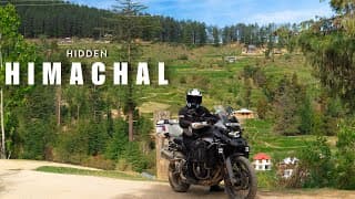
Jibhi to Anni
44 km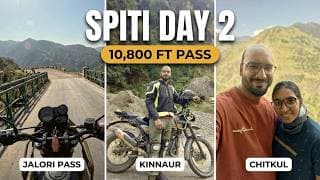
Gushaini to Banjar
10 kmNo video of this stretch yetFilmed it? Send the link. It plays on YouTube, with your name and the month.Add a video
Nearby routes
Ridden Jalori Pass, Tirthan valley and Shoja?
A trip report takes about three minutes. It fills in mechanics and puncture repair, mobile network, real riding hours and bikes riders took for the next rider. Or tap “Still true” on any fact you saw yourself.
Send a trip report