HP. At the start, in Bengaluru, 1 km off the road.
Karnataka hills: Coorg, Chikmagalur and Agumbe
Basic page · 347 facts
NH 275
873KM
Karnataka hills: Coorg, Chikmagalur and Agumbe
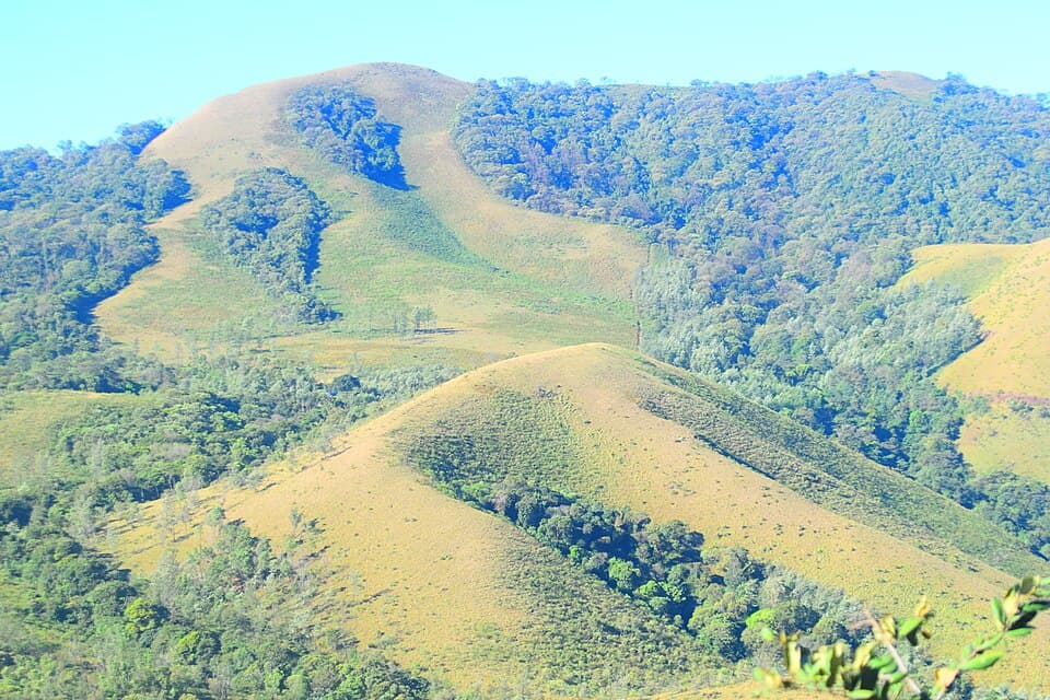
Karnataka's Western Ghats: coffee hills of Chikkamagaluru, the rainforest ghat at Agumbe, and Coorg
- Highest point
- 6,330 ft
- Best months
- Nov to Feb
- No fuel for
- 78 km
This is a basic page
No rider has reported on this route yet. What is here comes from official and published sources. How far to trust it
Before you leave
On this page
Fuel
316 pumpsBengaluru0 kmBengaluru873 km78 km · no pumpMullayanagiri299 kmSringeri377 km
From the open map, not yet checked
All 316 pumps were read from OpenStreetMap on 28 September 2026. No rider has confirmed any of them yet.
1 km from Bengaluru, 1 km off the road.
1 km from Bengaluru.
2 km from Bengaluru, 1 km off the road.
3 km from Bengaluru.
3 km from Bengaluru.
3 km from Bengaluru.
3 km from Bengaluru, 1 km off the road.
Show 308 more pumps
3 km from Bengaluru, 1 km off the road.
3 km from Bengaluru.
3 km from Bengaluru.
3 km from Bengaluru.
4 km from Bengaluru, 2 km off the road.
4 km from Bengaluru, 1 km off the road.
4 km from Bengaluru, 1 km off the road.
5 km from Bengaluru.
5 km from Bengaluru, 2 km off the road.
5 km from Bengaluru, 1 km off the road.
Indane Oil. 6 km from Bengaluru, 1 km off the road.
6 km from Bengaluru, 1 km off the road.
6 km from Bengaluru.
HP. 8 km from Bengaluru, 2 km off the road.
9 km from Bengaluru, 1 km off the road.
10 km from Bengaluru, 1 km off the road.
11 km from Bengaluru, 1 km off the road.
16 km from Bengaluru.
18 km from Bengaluru.
19 km from Bengaluru.
20 km from Bengaluru.
23 km from Bengaluru.
24 km from Bengaluru.
25 km from Bengaluru.
26 km from Bengaluru, 1 km off the road.
26 km from Bengaluru.
28 km from Bengaluru.
28 km from Bengaluru, 1 km off the road.
28 km from Bengaluru.
29 km from Bengaluru.
29 km from Bengaluru.
29 km from Bengaluru.
Indian Oil. 31 km from Bengaluru.
33 km from Bengaluru.
Bharat Petroleum. 33 km from Bengaluru.
33 km from Bengaluru.
34 km from Bengaluru.
35 km from Bengaluru.
36 km from Bengaluru.
37 km from Bengaluru.
38 km from Bengaluru.
39 km from Bengaluru, 1 km off the road.
43 km from Bengaluru.
44 km from Bengaluru.
Nayara. 47 km from Bengaluru.
47 km from Bengaluru.
48 km from Bengaluru.
48 km from Bengaluru.
53 km from Bengaluru.
54 km from Bengaluru.
54 km from Bengaluru.
57 km from Bengaluru.
60 km from Bengaluru.
66 km from Bengaluru, 1 km off the road.
68 km from Bengaluru.
HP. 69 km from Bengaluru.
70 km from Bengaluru.
74 km from Bengaluru, 1 km off the road.
Aegis Logistics Ltd. 74 km from Bengaluru.
74 km from Bengaluru.
75 km from Bengaluru.
75 km from Bengaluru, 1 km off the road.
76 km from Bengaluru.
79 km from Bengaluru.
86 km from Bengaluru.
88 km from Bengaluru.
99 km from Bengaluru.
103 km from Bengaluru.
117 km from Bengaluru.
122 km from Bengaluru.
123 km from Bengaluru.
126 km from Bengaluru.
126 km from Bengaluru.
Indian Oil. 146 km from Bengaluru.
147 km from Bengaluru.
147 km from Bengaluru.
147 km from Bengaluru.
147 km from Bengaluru.
148 km from Bengaluru, 1 km off the road.
151 km from Bengaluru.
176 km from Bengaluru.
177 km from Bengaluru, 1 km off the road.
181 km from Bengaluru, 2 km off the road.
183 km from Bengaluru.
195 km from Bengaluru.
210 km from Bengaluru.
212 km from Bengaluru.
218 km from Bengaluru, 1 km off the road.
218 km from Bengaluru, 1 km off the road.
218 km from Bengaluru, 1 km off the road.
221 km from Bengaluru.
HP. 260 km from Bengaluru.
294 km from Bengaluru.
299 km from Bengaluru.
Indian Oil, near Mullayanagiri
Last fuel for 78 km299 km from Bengaluru.
HP Petrol Bunk, near Sringeri
First fuel after the gap377 km from Bengaluru.
378 km from Bengaluru, 1 km off the road.
Indian Oil. 378 km from Bengaluru.
378 km from Bengaluru.
409 km from Bengaluru.
446 km from Bengaluru.
448 km from Bengaluru, 1 km off the road.
450 km from Bengaluru, 1 km off the road.
HP. 450 km from Bengaluru.
451 km from Bengaluru.
452 km from Bengaluru.
454 km from Bengaluru.
HP. 467 km from Bengaluru, 1 km off the road.
467 km from Bengaluru.
467 km from Bengaluru.
500 km from Bengaluru.
500 km from Bengaluru.
505 km from Bengaluru.
511 km from Bengaluru.
512 km from Bengaluru.
519 km from Bengaluru.
525 km from Bengaluru.
Elf Gas India Ltd. 525 km from Bengaluru.
525 km from Bengaluru.
525 km from Bengaluru.
HP. 527 km from Bengaluru, 1 km off the road.
561 km from Bengaluru.
561 km from Bengaluru.
563 km from Bengaluru.
610 km from Bengaluru.
610 km from Bengaluru.
HP. 612 km from Bengaluru.
Indian Oil. 612 km from Bengaluru.
628 km from Bengaluru.
637 km from Bengaluru.
639 km from Bengaluru.
640 km from Bengaluru.
641 km from Bengaluru, 1 km off the road.
642 km from Bengaluru.
Indian Oil. 643 km from Bengaluru.
644 km from Bengaluru.
647 km from Bengaluru.
653 km from Bengaluru.
659 km from Bengaluru.
661 km from Bengaluru.
663 km from Bengaluru.
663 km from Bengaluru.
663 km from Bengaluru.
665 km from Bengaluru.
668 km from Bengaluru.
670 km from Bengaluru.
685 km from Bengaluru.
686 km from Bengaluru.
Bharath. 686 km from Bengaluru.
HP. 687 km from Bengaluru.
Indian Oil. 687 km from Bengaluru.
687 km from Bengaluru.
688 km from Bengaluru.
689 km from Bengaluru.
693 km from Bengaluru.
694 km from Bengaluru.
695 km from Bengaluru.
703 km from Bengaluru.
706 km from Bengaluru.
707 km from Bengaluru.
716 km from Bengaluru.
716 km from Bengaluru.
721 km from Bengaluru.
721 km from Bengaluru, 1 km off the road.
721 km from Bengaluru, 1 km off the road.
722 km from Bengaluru, 1 km off the road.
724 km from Bengaluru.
724 km from Bengaluru.
724 km from Bengaluru, 1 km off the road.
724 km from Bengaluru, 1 km off the road.
Indian Oil. 724 km from Bengaluru, 2 km off the road.
728 km from Bengaluru, 2 km off the road.
731 km from Bengaluru.
733 km from Bengaluru.
734 km from Bengaluru.
735 km from Bengaluru.
735 km from Bengaluru.
735 km from Bengaluru.
736 km from Bengaluru.
Indian Oil. 738 km from Bengaluru.
741 km from Bengaluru, 1 km off the road.
744 km from Bengaluru, 1 km off the road.
744 km from Bengaluru, 1 km off the road.
744 km from Bengaluru.
745 km from Bengaluru, 1 km off the road.
747 km from Bengaluru.
753 km from Bengaluru.
760 km from Bengaluru.
761 km from Bengaluru.
761 km from Bengaluru.
766 km from Bengaluru, 1 km off the road.
766 km from Bengaluru, 1 km off the road.
767 km from Bengaluru, 1 km off the road.
770 km from Bengaluru, 2 km off the road.
771 km from Bengaluru, 2 km off the road.
771 km from Bengaluru, 2 km off the road.
772 km from Bengaluru, 2 km off the road.
772 km from Bengaluru, 2 km off the road.
Indian Oil. 772 km from Bengaluru, 2 km off the road.
772 km from Bengaluru, 2 km off the road.
772 km from Bengaluru, 2 km off the road.
772 km from Bengaluru, 2 km off the road.
773 km from Bengaluru, 2 km off the road.
774 km from Bengaluru, 1 km off the road.
774 km from Bengaluru.
776 km from Bengaluru.
776 km from Bengaluru.
781 km from Bengaluru.
781 km from Bengaluru.
785 km from Bengaluru.
785 km from Bengaluru.
790 km from Bengaluru.
791 km from Bengaluru.
791 km from Bengaluru, 1 km off the road.
791 km from Bengaluru, 1 km off the road.
791 km from Bengaluru, 1 km off the road.
792 km from Bengaluru, 2 km off the road.
794 km from Bengaluru, 1 km off the road.
794 km from Bengaluru, 1 km off the road.
797 km from Bengaluru.
800 km from Bengaluru.
804 km from Bengaluru.
807 km from Bengaluru, 1 km off the road.
808 km from Bengaluru, 1 km off the road.
808 km from Bengaluru, 1 km off the road.
831 km from Bengaluru.
835 km from Bengaluru.
836 km from Bengaluru.
838 km from Bengaluru.
838 km from Bengaluru, 1 km off the road.
842 km from Bengaluru, 2 km off the road.
843 km from Bengaluru.
844 km from Bengaluru.
Indian Oil. 845 km from Bengaluru.
846 km from Bengaluru.
847 km from Bengaluru.
847 km from Bengaluru.
848 km from Bengaluru, 1 km off the road.
850 km from Bengaluru.
851 km from Bengaluru, 1 km off the road.
852 km from Bengaluru, 1 km off the road.
852 km from Bengaluru.
854 km from Bengaluru.
855 km from Bengaluru.
855 km from Bengaluru.
856 km from Bengaluru.
857 km from Bengaluru, 1 km off the road.
Essay Petroleum. 858 km from Bengaluru.
858 km from Bengaluru.
858 km from Bengaluru.
858 km from Bengaluru, 1 km off the road.
858 km from Bengaluru, 1 km off the road.
Indian Oil. 858 km from Bengaluru.
858 km from Bengaluru, 1 km off the road.
860 km from Bengaluru.
860 km from Bengaluru.
861 km from Bengaluru.
861 km from Bengaluru.
861 km from Bengaluru.
861 km from Bengaluru.
861 km from Bengaluru, 1 km off the road.
862 km from Bengaluru, 1 km off the road.
862 km from Bengaluru.
862 km from Bengaluru.
862 km from Bengaluru.
862 km from Bengaluru.
863 km from Bengaluru.
863 km from Bengaluru.
Indian Oil. 863 km from Bengaluru.
864 km from Bengaluru, 1 km off the road.
864 km from Bengaluru, 1 km off the road.
HP. 864 km from Bengaluru, 2 km off the road.
Total. 864 km from Bengaluru.
Indian Oil. 864 km from Bengaluru, 2 km off the road.
864 km from Bengaluru.
864 km from Bengaluru.
865 km from Bengaluru.
865 km from Bengaluru.
865 km from Bengaluru, 1 km off the road.
866 km from Bengaluru.
866 km from Bengaluru.
867 km from Bengaluru.
867 km from Bengaluru.
867 km from Bengaluru.
867 km from Bengaluru.
867 km from Bengaluru.
868 km from Bengaluru.
868 km from Bengaluru.
Indian Oil. 868 km from Bengaluru.
868 km from Bengaluru.
869 km from Bengaluru.
869 km from Bengaluru, 1 km off the road.
869 km from Bengaluru, 1 km off the road.
AEGIS AUTO GAS. 869 km from Bengaluru.
870 km from Bengaluru, 1 km off the road.
870 km from Bengaluru, 1 km off the road.
871 km from Bengaluru, 1 km off the road.
871 km from Bengaluru.
871 km from Bengaluru, 1 km off the road.
871 km from Bengaluru.
871 km from Bengaluru, 1 km off the road.
871 km from Bengaluru.
872 km from Bengaluru, 1 km off the road.
872 km from Bengaluru, 1 km off the road.
872 km from Bengaluru, 1 km off the road.
872 km from Bengaluru, 1 km off the road.
872 km from Bengaluru.
873 km from Bengaluru, 1 km off the road.
Rules for motorcycles
5 factsMullayanagiri: book a time slot online
Not yet checkedVehicles book a morning slot (6 am to noon) or afternoon slot (1 pm to 6 pm). Each slot takes 600 vehicles, 100 of them two-wheelers.
From daijiworld.com · dated 30 August 2025 · read 28 September 2026 · no rider has confirmed it
Mullayanagiri: toll paid when booking
Not yet checkedThe booking form lists Bike as a vehicle type and charges the toll online. The amount appears only after a slot is chosen.
From pgbiz.omniware.in · read 28 September 2026 · no rider has confirmed it
Agumbe ghat: heavy vehicles barred in monsoon
Not yet checkedFrom 15 June to 30 September only light vehicles may use the ghat. Motorcycles may pass. Expect sudden closures after slides.
From daijiworld.com · dated 26 June 2026 · read 28 September 2026 · no rider has confirmed it
Nagarahole: forest gates shut at 6 pm
Not yet checkedGates into the reserve close at 6 pm and entering later is an offence. A travel wiki adds that two-wheelers are refused on the Kutta road.
No government order found · from deccanherald.com · dated 22 October 2023 · read 28 September 2026 · no rider has confirmed it
Bengaluru to Mysuru Expressway: no two-wheelers
Not yet checkedRiders heading for Coorg through Mysuru must use the toll-free service road beside the expressway, not the main carriageway.
From thefederal.com · dated 26 July 2023 · read 28 September 2026 · no rider has confirmed it
Trouble on the road
4 warningsFrom published guides, not from riders
Each warning names the months it applies to. None has been seen by a rider this season unless it says so.
Landslides on the Agumbe ghat
Not yet checkedSlopes give way in heavy rain. Both district heads restrict traffic every monsoon.
From daijiworld.com · dated 26 June 2026 · read 28 September 2026 · no rider has confirmed it
Extreme rain at Agumbe
Not yet checkedAbout 7,600 millimetres of rain a year, most of it in July and August. Carry waterproofs.
From en.wikipedia.org · read 28 September 2026 · no rider has confirmed it
Narrow road on the Agumbe ghat
Not yet checkedBetween Someshwara and Agumbe the road is too narrow for full-size buses. Watch for oncoming vehicles on bends.
From en.wikipedia.org · read 28 September 2026 · no rider has confirmed it
Narrow, crowded road to Mullayanagiri
Not yet checkedThe district cites accidents and jams on the hill stretch as the reason for vehicle caps.
From daijiworld.com · dated 30 August 2025 · read 28 September 2026 · no rider has confirmed it
Videos
2 rider videosWatch the date, not the view
Each video shows the road as it was that month. They play on YouTube, under the maker’s own channel.
Bengaluru to Mullayanagiri
271 km
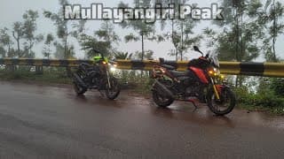
Chikkamagaluru to Mullayanagiri and Bababudangiri
Mullayanagiri to Bengaluru
602 kmNo video of this stretch yetFilmed it? Send the link. It plays on YouTube, with your name and the month.Add a video
Not here yet
Mechanics and puncture repair
Mobile network
Real riding hours
Stays
These come from riders, not from us
They appear when riders who have done this route send a trip report. It takes about three minutes.
What a trip report asks
Route, month and bikeNeeded
Riding hours, fuel stops, mechanics, gear, cost, a videoOptional. Fill in what you remember.
Bikes, gear and costs show after 10 trip reportsWith fewer, this would be a handful of opinions, not a pattern.
0 of 10 reports
0 trip reports for Karnataka hills: Coorg, Chikmagalur and Agumbe so far
Also
0 trip reports for Karnataka hills: Coorg, Chikmagalur and Agumbe so far
Ridden it? Send a trip report