At the start, in Panaji, 1 km off the road.
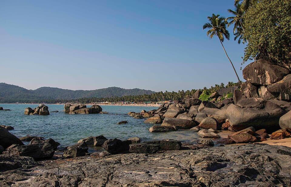
Goa, Gokarna and the Karnataka coast
165 facts
NH 66
398KM
Goa, Gokarna and the Karnataka coast
Goa and Karnataka, down the west coast from Panaji to Mangaluru
- Highest point
- 460 ft
- No fuel for
- 31 km
No rider has checked these facts yet
Each one shows where it came from and when. Ridden it? Tap “Still true” on what you saw, or “This has changed”. How far to trust it
Before you leave
On this page
Fuel
104 pumpsPanaji0 kmMangaluru398 km
From the open map, not yet checked
All 104 pumps were read from OpenStreetMap on 28 September 2026. No rider has confirmed any of them yet.
At the start, in Panaji.
At the start, in Panaji, 1 km off the road.
1 km from Panaji.
1 km from Panaji.
1 km from Panaji.
2 km from Panaji, 1 km off the road.
2 km from Panaji.
Show 96 more pumps
11 km from Panaji.
Indian Oil. 20 km from Panaji.
20 km from Panaji.
21 km from Panaji.
HP. 22 km from Panaji.
33 km from Panaji, 1 km off the road.
33 km from Panaji, 1 km off the road.
33 km from Panaji, 1 km off the road.
33 km from Panaji, 1 km off the road.
33 km from Panaji, 1 km off the road.
HP. 37 km from Panaji.
44 km from Panaji.
46 km from Panaji.
55 km from Panaji.
HP. 66 km from Panaji.
81 km from Panaji.
HP. 86 km from Panaji.
86 km from Panaji.
101 km from Panaji.
104 km from Panaji.
108 km from Panaji.
128 km from Panaji.
130 km from Panaji.
132 km from Panaji, 1 km off the road.
154 km from Panaji.
162 km from Panaji.
167 km from Panaji.
187 km from Panaji.
204 km from Panaji.
207 km from Panaji, 1 km off the road.
238 km from Panaji.
239 km from Panaji.
248 km from Panaji.
259 km from Panaji.
261 km from Panaji.
265 km from Panaji.
267 km from Panaji.
270 km from Panaji.
274 km from Panaji.
275 km from Panaji.
277 km from Panaji.
279 km from Panaji.
Indane. 305 km from Panaji.
306 km from Panaji.
312 km from Panaji.
312 km from Panaji.
316 km from Panaji.
320 km from Panaji.
326 km from Panaji.
HP. 329 km from Panaji.
335 km from Panaji.
336 km from Panaji, 1 km off the road.
336 km from Panaji, 1 km off the road.
337 km from Panaji, 1 km off the road.
339 km from Panaji.
339 km from Panaji, 1 km off the road.
340 km from Panaji.
341 km from Panaji.
341 km from Panaji.
Aegis Logistics Ltd. 345 km from Panaji.
345 km from Panaji.
354 km from Panaji.
356 km from Panaji.
360 km from Panaji.
364 km from Panaji.
HP. 364 km from Panaji.
366 km from Panaji.
372 km from Panaji.
373 km from Panaji.
375 km from Panaji.
379 km from Panaji.
383 km from Panaji.
384 km from Panaji.
387 km from Panaji.
387 km from Panaji.
387 km from Panaji.
387 km from Panaji.
387 km from Panaji.
387 km from Panaji.
387 km from Panaji.
GAIL. 388 km from Panaji.
388 km from Panaji.
Indian Oil. 388 km from Panaji.
388 km from Panaji.
389 km from Panaji.
389 km from Panaji.
391 km from Panaji.
392 km from Panaji.
392 km from Panaji.
393 km from Panaji.
395 km from Panaji.
395 km from Panaji.
395 km from Panaji.
397 km from Panaji.
398 km from Panaji.
At the end of the route.
Cash: ATMs and banks
14 halts| Halt | ATMs | Banks |
|---|---|---|
| PanajiAxis Bank, Axis Bank ATM, Axis Bank Branch, Bajaj Finserv, Bank of Baroda, Bank of Maharashtra | 20 | 47 |
| Between Panaji and PalolemAllahabad Bank, Axis Bank, Axis Bank ATM, Axis Bank Branch, Bajaj Finserv, Bandhan Bank ATM | 14 | 35 |
| PalolemAxis Bank, Axis Bank ATM, Axis Bank Branch, Bank of Baroda, Bank of Maharashtra, Canara Bank | 4 | 7 |
| KarwarAxis Bank, Axis Bank ATM, Bank of Baroda, Bank of Maharashtra, Canara Bank, Federal Bank ATM | 11 | 7 |
| Between Karwar and GokarnaAxis Bank Branch, Indian Overseas Bank - ATM | 1 | 1 |
| GokarnaAxis Bank ATM, Bank of Baroda, ICICI Bank, ICICI Bank Mirjan-Branch & ATM | 2 | 3 |
| Between Gokarna and MurudeshwarAxis Bank, Axis Bank ATM, Axis Bank Branch, Bank of Baroda, HDFC Bank, HDFC Bank ATM | 4 | 11 |
| MurudeshwarAxis Bank, Axis Bank Branch, Bank of Baroda, Bhatkal Agriculture & Rural Development Co-Operative Bank-Murudeshwara, Federal Bank ATM, HDFC Bank | 4 | 10 |
| Between Murudeshwar and MaravantheAxis Bank | 1 | 0 |
| MaravantheAxis Bank, Axis Bank Branch, Bank of Baroda, Federal Bank, HDFC Bank, HDFC Bank ATM | 9 | 15 |
| Between Maravanthe and UdupiBank of Baroda, HDFC Bank, HDFC Bank ATM, Karnataka Bank - Kota Branch, Karnataka Bank ATM | 2 | 3 |
| UdupiAnnapoorna Renovation & Interior Designer Udupi, Axis Bank, Axis Bank ATM, Axis Bank Branch, Axis Bank Brank, Bajaj Finserv | 17 | 37 |
| Between Udupi and MangaluruAxis Bank ATM, Axis Bank Branch, HDFC Bank | 1 | 2 |
| MangaluruAxis Bank, Axis Bank ATM, Axis Bank Branch, Bajaj Finserv, Bank of Baroda, Bank of Maharashtra - Mangalore Branch | 30 | 64 |
Listed on a public map (Overture Maps). An ATM on the map can be empty or out of order, and no rider has confirmed these yet.
Rules for motorcycles
7 factsRider and pillion both. Central law makes a helmet compulsory for anyone over four on a two-wheeler; in January 2026 Goa said it would enforce the pillion rule in phases.
From prsindia.org · dated 9 August 2019 · read 17 October 2026
Hire motorcycles are licensed under the Rent a Motorcycle Scheme, 1997, and the renter signs an undertaking. The Transport Department lists the orders and the form.
From goatransport.gov.in · read 28 September 2026
The Transport Department site has a lookup that takes a Goa registration number and shows whether the vehicle holds a permit.
From goatransport.gov.in · read 28 September 2026
Only vehicles registered for hire may be rented. The government said in 2022 that owners renting out private vehicles face penalties and possible licence suspension.
No government order found · from thegoan.net · dated 20 October 2022 · read 28 September 2026
A rental company says many hire vehicles are tracked and fenced to stop them crossing the state border. This is a rental term; no government order was found.
No government order found · from motoshare.in · dated 20 February 2025 · read 28 September 2026
Driving any vehicle on a beach is an offence. Beaches are open from 7 am to sunset. Carry your licence while riding.
From goatourism.gov.in · read 28 September 2026
In July 2026 the district administration barred tourists from dangerous areas and from bathing in waterfalls, including those beside the highway near Karwar and Ankola.
From newsable.asianetnews.com · dated 3 July 2026 · read 28 September 2026
Trouble on the road
3 warningsFrom published guides, not from riders
Each warning names the months it applies to. None has been seen by a rider this season unless it says so.
A landslide at Shirur near Ankola on 16 July 2024 buried vehicles and shut the highway. The district has 324 spots marked as prone to landslides.
From newsonair.gov.in · dated 18 July 2024 · read 28 September 2026
In the rains, waterfalls form on the rock cuttings of the widened highway near Karwar and Ankola, and visitors stop their vehicles on the carriageway.
From newsable.asianetnews.com · dated 3 July 2026 · read 28 September 2026
The monsoon reached coastal Karnataka in late May in 2025, with a red alert, fallen trees and flooding. June to August are the wettest months.
From newsonair.gov.in · dated 25 May 2025 · read 28 September 2026
Mechanics
25 shopsNot listed: Mangaluru (43 shops on the map), Udupi (19 shops on the map), Panaji (15 shops on the map). This list is for the halts between, where repair shops are few.
Vehicle repair
From the open map · dated 22 October 2026 · read 8 November 2026
Showroom and service centre
From the open map · dated 22 October 2026 · read 8 November 2026
Motorcycle repair
From the open map · dated 22 October 2026 · read 8 November 2026
Motorcycle repair, 1.5 km off the road
From the open map · dated 22 October 2026 · read 8 November 2026
Showroom and service centre, 1.5 km off the road
From the open map · dated 22 October 2026 · read 8 November 2026
Tyres and punctures
From the open map · dated 22 October 2026 · read 8 November 2026
Tyres and punctures
From the open map · dated 22 October 2026 · read 8 November 2026
Vehicle repair
From the open map · dated 22 October 2026 · read 8 November 2026
Showroom and service centre
From the open map · dated 22 October 2026 · read 8 November 2026
Showroom and service centre
From the open map · dated 22 October 2026 · read 8 November 2026
Showroom and service centre
From the open map · dated 22 October 2026 · read 8 November 2026
Tyres and punctures
From the open map · dated 22 October 2026 · read 8 November 2026
Vehicle repair
From the open map · dated 22 October 2026 · read 8 November 2026
Tyres and punctures
From the open map · dated 22 October 2026 · read 8 November 2026
Tyres and punctures
From the open map · dated 22 October 2026 · read 8 November 2026
Showroom and service centre
From the open map · dated 22 October 2026 · read 8 November 2026
Tyres and punctures
From the open map · dated 22 October 2026 · read 8 November 2026
Tyres and punctures
From the open map · dated 22 October 2026 · read 8 November 2026
Tyres and punctures
From the open map · dated 22 October 2026 · read 8 November 2026
Tyres and punctures
From the open map · dated 22 October 2026 · read 8 November 2026
Motorcycle repair
From the open map · dated 22 October 2026 · read 8 November 2026
Showroom and service centre
From the open map · dated 22 October 2026 · read 8 November 2026
Showroom and service centre
From the open map · dated 22 October 2026 · read 8 November 2026
Showroom and service centre
From the open map · dated 22 October 2026 · read 8 November 2026
Tyres and punctures
From the open map · dated 22 October 2026 · read 8 November 2026
Stays
0 placesPlenty at every halt
Every halt on this route has many, so Meel does not list them one by one. On the open map: Panaji 311 places to stay, Mangaluru 238 places to stay, Palolem 220 places to stay, Udupi 122 places to stay, Gokarna 83 places to stay, and 3 more halts.
Videos
5 rider videosWatch the date, not the view
Each video shows the road as it was that month. They play on YouTube, under the maker’s own channel.
Panaji to Gokarna
157 km
Udupi to Gokarna
184 km
The whole route
Murudeshwar to Gokarna
77 km

Nearby routes
Ridden Goa, Gokarna and the Karnataka coast?
A trip report takes about three minutes. It fills in mobile network, real riding hours, bikes riders took and what the trip cost for the next rider. Or tap “Still true” on any fact you saw yourself.
Send a trip report