1 km from Siliguri.
From the open map · read 6 October 2026
100 facts
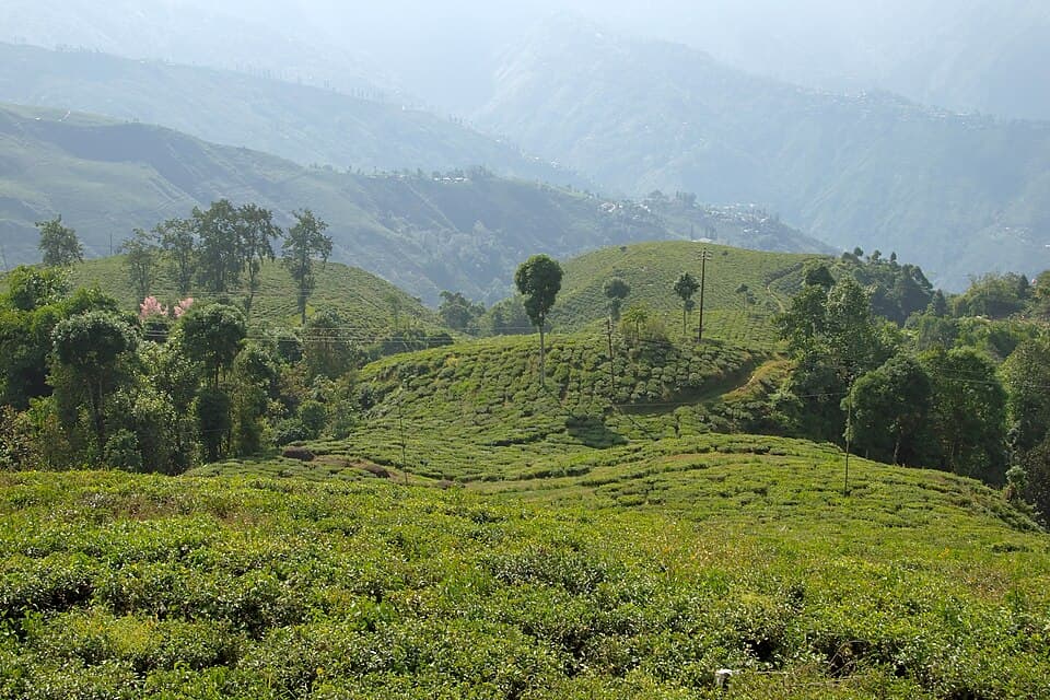
North Bengal hills: Siliguri up to Darjeeling, the Singalila ridge to Sandakphu, and across to Kalimpong
1 km from Siliguri.
From the open map · read 6 October 2026
2 km from Siliguri.
From the open map · read 6 October 2026
2 km from Siliguri.
From the open map · read 6 October 2026
3 km from Siliguri.
From the open map · read 6 October 2026
3 km from Siliguri.
From the open map · read 6 October 2026
4 km from Siliguri.
From the open map · read 6 October 2026
4 km from Siliguri.
From the open map · read 6 October 2026
7 km from Siliguri.
From the open map · read 6 October 2026
10 km from Siliguri.
From the open map · read 6 October 2026
13 km from Siliguri.
From the open map · read 6 October 2026
37 km from Siliguri.
From the open map · read 6 October 2026
63 km from Siliguri.
From the open map · read 6 October 2026
65 km from Siliguri.
From the open map · read 6 October 2026
69 km from Siliguri, 1 km off the road.
From the open map · read 6 October 2026
218 km from Siliguri.
From the open map · read 6 October 2026
407 km from Siliguri.
From the open map · read 6 October 2026
482 km from Siliguri.
From the open map · read 6 October 2026
Indian Oil. 528 km from Siliguri.
From locator.iocl.com · read 6 October 2026
HP. 532 km from Siliguri.
From petrolpump.hpretail.in · read 6 October 2026
| Halt | ATMs | Banks |
|---|---|---|
| SiliguriAllahabad Bank, Axis Bank, Axis Bank ATM, Axis Bank Branch, Bajaj Finserv AMC Partner - Bidhan Road, Bandhan Bank | 19 | 45 |
| KurseongAxis Bank ATM, Axis Bank Branch, Bank of Baroda, HDFC Bank, ICICI Bank | 1 | 4 |
| ManebhanjanAxis Bank ATM, HDFC Bank ATM | 2 | 0 |
| DarjeelingAxis Bank, Axis Bank ATM, Bank of Baroda, Bank of India, Bubble Beds Darjeeling, HDFC Bank | 6 | 10 |
| KalimpongAxis Bank, Bandhan Bank, Bank of Baroda, Darjeeling District Central Cooperative Bank ATM, HDFC Bank, HDFC Bank ATM | 5 | 8 |
Listed on a public map (Overture Maps). An ATM on the map can be empty or out of order, and no rider has confirmed these yet.
Motorcycles are turned back at the Manebhanjan check post since April 2018, after a forest officer's notice. A blog updated September 2026 says this still holds. Notice text not found.
No government order found · from darjeeling-tourism.com · read 28 September 2026
Visitors change at Manebhanjan to vehicles of the local Land Rover owners' association. A travel site says private cars need its consent, rarely given. No government order found.
No government order found · from darjeeling-tourism.com · read 28 September 2026
Issued at the Forest Department office in Manebhanjan against photo identity; foreign citizens show a passport. A blog says a guide is compulsory inside the park.
No government order found · from darjeeling-tourism.com · read 28 September 2026
Closed to visitors from 16 June to 15 September every year. One travel site gives 15 June as the first day.
No government order found · from en.wikipedia.org · dated 21 September 2026 · read 28 September 2026
Darjeeling Police host a health advisory for Sandakphu visitors on their website. The file could not be opened, so its contents are not recorded.
From darjeelingpolice.wb.gov.in · read 28 September 2026
No vehicles from 9 pm to 6 am on 7 to 15 October and 26 October to 5 November 2026, for slope works. Reported in the news; the order was not read.
From voiceofsikkim.com · dated 4 October 2026 · read 15 October 2026
Rain on 4 and 5 October 2025 brought down the Dudhia bridge and damaged Rohini Road. A temporary bridge opened on 27 October 2025.
From millenniumpost.in · dated 27 October 2025 · read 28 September 2026
After the October 2025 damage one bypass was shut following a fatal accident and another was kept for emergency and school vehicles only.
From millenniumpost.in · dated 27 October 2025 · read 28 September 2026
The road along the Teesta was shut for six days in August 2025 after it collapsed near 9th Mile. Repeated slides slowed repairs.
From newsonair.gov.in · dated 17 August 2025 · read 28 September 2026


From Wikimedia Commons, the newest dated photo near each pass and high halt. A photo shows the road on the day it was taken, not today.
Not listed: Siliguri (34 shops on the map). This list is for the halts between, where repair shops are few.
Showroom and service centre
From the open map · dated 22 October 2026 · read 8 November 2026
Showroom and service centre
From the open map · dated 22 October 2026 · read 8 November 2026
Vehicle repair
From the open map · dated 22 October 2026 · read 8 November 2026
Motorcycle repair, 1.5 km off the road
From the open map · dated 22 October 2026 · read 8 November 2026
Showroom and service centre
From the open map · dated 22 October 2026 · read 8 November 2026
Showroom and service centre
From the open map · dated 22 October 2026 · read 8 November 2026
Showroom and service centre
From the open map · dated 22 October 2026 · read 8 November 2026
Tyres and punctures
From the open map · dated 22 October 2026 · read 8 November 2026
Showroom and service centre
From the open map · dated 22 October 2026 · read 8 November 2026
Vehicle repair
From the open map · dated 22 October 2026 · read 8 November 2026
Tyres and punctures
From the open map · dated 22 October 2026 · read 8 November 2026
Not listed: Darjeeling (816 places on the map), Siliguri (385 places on the map), Kalimpong (269 places on the map), Kurseong (81 places on the map). This list is for the halts between, where rooms are few.
Homestay, 2.9 km off the road
From the open map · dated 22 October 2026 · read 8 November 2026
Hotel
From the open map · dated 22 October 2026 · read 8 November 2026
Homestay
From the open map · dated 22 October 2026 · read 8 November 2026
Homestay
From the open map · dated 22 October 2026 · read 8 November 2026
Bed and breakfast
From the open map · dated 22 October 2026 · read 8 November 2026
Resort
From the open map · dated 22 October 2026 · read 8 November 2026
Hotel
From the open map · dated 22 October 2026 · read 8 November 2026
Homestay
From the open map · dated 22 October 2026 · read 8 November 2026
Homestay
From the open map · dated 22 October 2026 · read 8 November 2026
Homestay
From the open map · dated 22 October 2026 · read 8 November 2026
Homestay
From the open map · dated 22 October 2026 · read 8 November 2026
Homestay
From the open map · dated 22 October 2026 · read 8 November 2026
Homestay
From the open map · dated 22 October 2026 · read 8 November 2026
Guest house, 1.7 km off the road
From the open map · dated 22 October 2026 · read 8 November 2026
Resort, 2.8 km off the road
From the open map · dated 22 October 2026 · read 8 November 2026
Hotel, 1.6 km off the road
From the open map · dated 22 October 2026 · read 8 November 2026
Hotel, 2.7 km off the road
From the open map · dated 22 October 2026 · read 8 November 2026
Homestay
From the open map · dated 22 October 2026 · read 8 November 2026
Hotel
From the open map · dated 22 October 2026 · read 8 November 2026
Homestay
From the open map · dated 22 October 2026 · read 8 November 2026
Hotel, 2.4 km off the road
From the open map · dated 22 October 2026 · read 8 November 2026
Homestay, 2.0 km off the road
From the open map · dated 22 October 2026 · read 8 November 2026
Homestay
From the open map · dated 22 October 2026 · read 8 November 2026
Homestay
From the open map · dated 22 October 2026 · read 8 November 2026
Homestay
From the open map · dated 22 October 2026 · read 8 November 2026
Campsite
From the open map · dated 22 October 2026 · read 8 November 2026
Homestay
From the open map · dated 22 October 2026 · read 8 November 2026
Cottage
From the open map · dated 22 October 2026 · read 8 November 2026
Hotel
From the open map · dated 22 October 2026 · read 8 November 2026
Hotel
From the open map · dated 22 October 2026 · read 8 November 2026
Homestay
From the open map · dated 22 October 2026 · read 8 November 2026
Hotel, 2.3 km off the road
From the open map · dated 22 October 2026 · read 8 November 2026
Hotel, 1.3 km off the road
From the open map · dated 22 October 2026 · read 8 November 2026
Hotel
From the open map · dated 22 October 2026 · read 8 November 2026
Hotel, 2.4 km off the road
From the open map · dated 22 October 2026 · read 8 November 2026
Hotel
From the open map · dated 22 October 2026 · read 8 November 2026
A trip report takes about three minutes. It fills in mobile network, real riding hours, bikes riders took and what the trip cost for the next rider. Or tap “Still true” on any fact you saw yourself.
Send a trip report