1 km from Bhuj.
From the open map · read 6 October 2026
60 facts
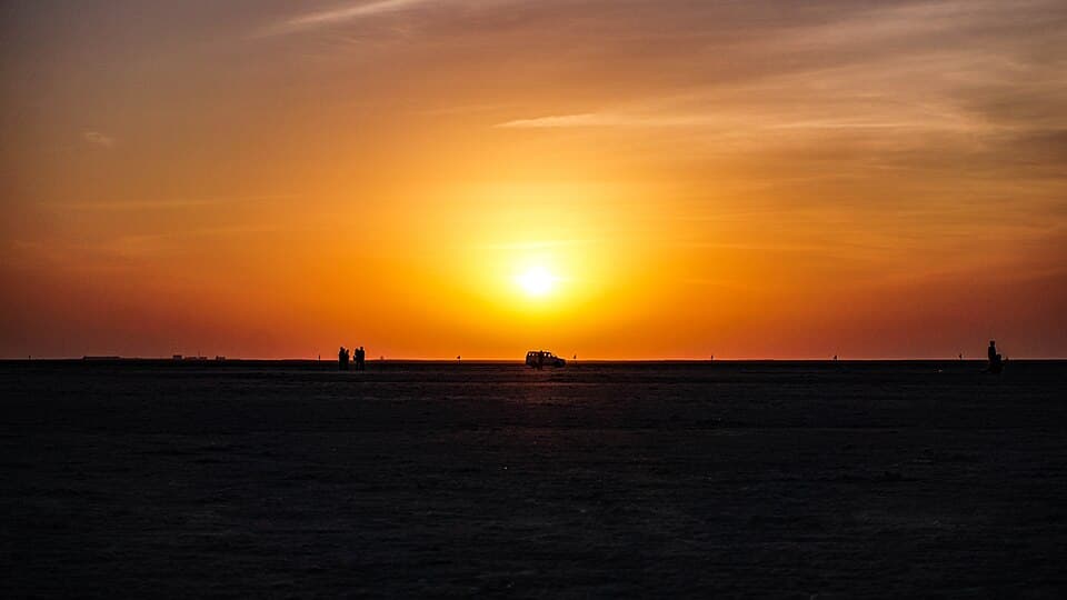
Gujarat, from Bhuj to the salt desert at Dhordo and across to Dholavira
1 km from Bhuj.
From the open map · read 6 October 2026
2 km from Bhuj.
From the open map · read 6 October 2026
HP. 10 km from Bhuj.
From petrolpump.hpretail.in · read 6 October 2026
HP. 20 km from Bhuj.
From petrolpump.hpretail.in · read 6 October 2026
Indian Oil. 27 km from Bhuj.
From locator.iocl.com · read 6 October 2026
HP. 122 km from Bhuj.
From petrolpump.hpretail.in · read 6 October 2026
| Halt | ATMs | Banks |
|---|---|---|
| BhujAxis Bank, Axis Bank ATM, Axis Bank Branch, Bajaj Finserv, Bajaj Finserv Service Branch, Bank of Baroda | 11 | 30 |
| KhavdaBank of Baroda | 0 | 1 |
Listed on a public map (Overture Maps). An ATM on the map can be empty or out of order, and no rider has confirmed these yet.
Book online or at Bhirandiyara checkpost; the lead traveller uploads identity proof. Adults 100 rupees, children six to twelve 50 rupees, two-wheelers listed at no charge.
From rannpermit.gujarat.gov.in · read 28 September 2026
The government portal accepts Indian nationals only. An operator says foreign visitors give passport and visa details and should allow more time.
From rannpermit.gujarat.gov.in · read 28 September 2026
An operator says the White Rann permit is checked again at a second checkpost on the way to Kalo Dungar. No government order was found.
No government order found · from rannutsavtickets.in · dated 14 August 2026 · read 28 September 2026
Past India Bridge near Khavda the area is closed to civilians; entry needs special permission from the Border Security Force. No government order was found.
No government order found · from en.wikipedia.org · read 28 September 2026
A travel site says an army checkpost near Khavda checks original photo identity, the road has no entry fee, and motorcycles are allowed. No government order found.
No government order found · from kutchdiaries.com · read 28 September 2026
No pumps on the 30 kilometre stretch across the Rann; fill up at Bhuj or Khavda first.
From kutchdiaries.com · read 28 September 2026
The salt flats hold water about half a metre to one and a half metres deep until they dry in October or November.
From en.wikipedia.org · read 28 September 2026
Not listed: Bhuj (108 places on the map). This list is for the halts between, where rooms are few.
Resort
From the open map · dated 22 October 2026 · read 8 November 2026
Resort
From the open map · dated 22 October 2026 · read 8 November 2026
Hotel
From the open map · dated 22 October 2026 · read 8 November 2026
Hotel
From the open map · dated 22 October 2026 · read 8 November 2026
Resort
From the open map · dated 22 October 2026 · read 8 November 2026
Resort
From the open map · dated 22 October 2026 · read 8 November 2026
Hotel
From the open map · dated 22 October 2026 · read 8 November 2026
Resort
From the open map · dated 22 October 2026 · read 8 November 2026
Resort
From the open map · dated 22 October 2026 · read 8 November 2026
Resort
From the open map · dated 22 October 2026 · read 8 November 2026
Hotel
From the open map · dated 22 October 2026 · read 8 November 2026
Campsite, 2.6 km off the road
From the open map · dated 22 October 2026 · read 8 November 2026
Hotel, 2.6 km off the road
From the open map · dated 22 October 2026 · read 8 November 2026
Homestay, 2.6 km off the road
From the open map · dated 22 October 2026 · read 8 November 2026
Resort
From the open map · dated 22 October 2026 · read 8 November 2026
Resort
From the open map · dated 22 October 2026 · read 8 November 2026
Hotel, 2.6 km off the road
From the open map · dated 22 October 2026 · read 8 November 2026
Homestay
From the open map · dated 22 October 2026 · read 8 November 2026
Homestay
From the open map · dated 22 October 2026 · read 8 November 2026
Resort
From the open map · dated 22 October 2026 · read 8 November 2026
Resort
From the open map · dated 22 October 2026 · read 8 November 2026
Resort
From the open map · dated 22 October 2026 · read 8 November 2026
Resort
From the open map · dated 22 October 2026 · read 8 November 2026
Campsite
From the open map · dated 22 October 2026 · read 8 November 2026
Resort
From the open map · dated 22 October 2026 · read 8 November 2026
Resort
From the open map · dated 22 October 2026 · read 8 November 2026
Resort
From the open map · dated 22 October 2026 · read 8 November 2026
Resort, 1.4 km off the road
From the open map · dated 22 October 2026 · read 8 November 2026
Resort
From the open map · dated 22 October 2026 · read 8 November 2026
Resort
From the open map · dated 22 October 2026 · read 8 November 2026
A trip report takes about three minutes. It fills in mobile network, real riding hours, bikes riders took and what the trip cost for the next rider. Or tap “Still true” on any fact you saw yourself.
Send a trip report