At the start, in Bhopal, 1 km off the road.
From the open map · read 6 October 2026
129 facts
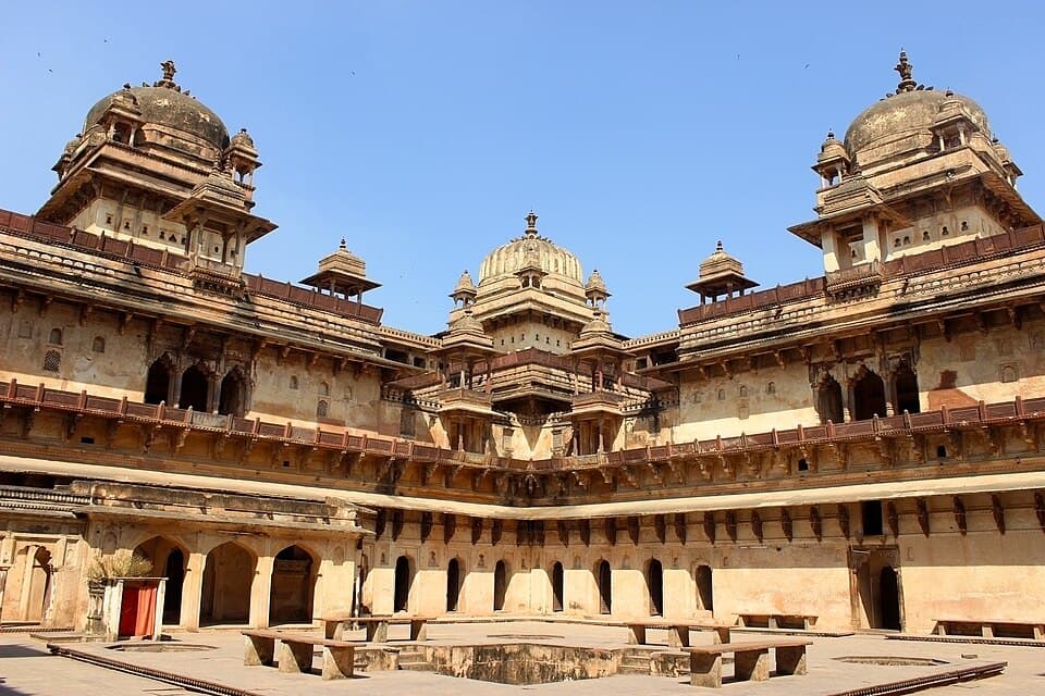
Madhya Pradesh, from the Satpura hills at Pachmarhi to the temples of Khajuraho and Orchha
At the start, in Bhopal, 1 km off the road.
From the open map · read 6 October 2026
2 km from Bhopal, 1 km off the road.
From the open map · read 6 October 2026
6 km from Bhopal, 1 km off the road.
From the open map · read 6 October 2026
6 km from Bhopal, 1 km off the road.
From the open map · read 6 October 2026
7 km from Bhopal, 2 km off the road.
From the open map · read 6 October 2026
7 km from Bhopal, 1 km off the road.
From the open map · read 6 October 2026
8 km from Bhopal, 1 km off the road.
From the open map · read 6 October 2026
8 km from Bhopal, 2 km off the road.
From the open map · read 6 October 2026
9 km from Bhopal.
From the open map · read 6 October 2026
Indian Oil. 11 km from Bhopal.
From the open map · read 6 October 2026
12 km from Bhopal, 2 km off the road.
From the open map · read 6 October 2026
HP. 12 km from Bhopal, 2 km off the road.
From the open map · read 6 October 2026
15 km from Bhopal.
From the open map · read 6 October 2026
20 km from Bhopal.
From the open map · read 6 October 2026
38 km from Bhopal, 1 km off the road.
From the open map · read 6 October 2026
77 km from Bhopal.
From the open map · read 6 October 2026
HP. 84 km from Bhopal.
From petrolpump.hpretail.in · read 6 October 2026
HP. 92 km from Bhopal.
From the open map · read 6 October 2026
94 km from Bhopal.
From the open map · read 6 October 2026
95 km from Bhopal.
From the open map · read 6 October 2026
HP. 105 km from Bhopal.
From petrolpump.hpretail.in · read 6 October 2026
Nayara. 111 km from Bhopal.
From the open map · read 6 October 2026
124 km from Bhopal.
From the open map · read 6 October 2026
126 km from Bhopal.
From the open map · read 6 October 2026
Indian Oil. 135 km from Bhopal.
From locator.iocl.com · read 6 October 2026
HP. 138 km from Bhopal.
From petrolpump.hpretail.in · read 6 October 2026
145 km from Bhopal, 1 km off the road.
From the open map · read 6 October 2026
Indian Oil. 146 km from Bhopal, 1 km off the road.
From the open map · read 6 October 2026
Indian Oil. 163 km from Bhopal.
From locator.iocl.com · read 6 October 2026
196 km from Bhopal, 1 km off the road.
From the open map · read 6 October 2026
Indian Oil. 219 km from Bhopal, 2 km off the road.
From locator.iocl.com · read 6 October 2026
HP. 276 km from Bhopal.
From petrolpump.hpretail.in · read 6 October 2026
Indian Oil. 278 km from Bhopal.
From locator.iocl.com · read 6 October 2026
Indian Oil. 282 km from Bhopal.
From locator.iocl.com · read 6 October 2026
Indian Oil. 293 km from Bhopal, 2 km off the road.
From locator.iocl.com · read 6 October 2026
Indian Oil. 299 km from Bhopal.
From locator.iocl.com · read 6 October 2026
Indian Oil. 303 km from Bhopal.
From locator.iocl.com · read 6 October 2026
Indian Oil. 306 km from Bhopal, 2 km off the road.
From locator.iocl.com · read 6 October 2026
HP. 307 km from Bhopal, 2 km off the road.
From petrolpump.hpretail.in · read 6 October 2026
Indian Oil. 307 km from Bhopal.
From locator.iocl.com · read 6 October 2026
HP. 309 km from Bhopal.
From petrolpump.hpretail.in · read 6 October 2026
Indian Oil. 317 km from Bhopal.
From locator.iocl.com · read 6 October 2026
HP. 340 km from Bhopal.
From petrolpump.hpretail.in · read 6 October 2026
HP. 340 km from Bhopal, 1 km off the road.
From petrolpump.hpretail.in · read 6 October 2026
Indian Oil. 341 km from Bhopal, 2 km off the road.
From locator.iocl.com · read 6 October 2026
HP. 374 km from Bhopal.
From petrolpump.hpretail.in · read 6 October 2026
392 km from Bhopal, 1 km off the road.
From the open map · read 6 October 2026
393 km from Bhopal, 1 km off the road.
From the open map · read 6 October 2026
393 km from Bhopal, 1 km off the road.
From the open map · read 6 October 2026
395 km from Bhopal.
From the open map · read 6 October 2026
395 km from Bhopal.
From the open map · read 6 October 2026
397 km from Bhopal.
From the open map · read 6 October 2026
408 km from Bhopal, 1 km off the road.
From the open map · read 6 October 2026
410 km from Bhopal.
From the open map · read 6 October 2026
410 km from Bhopal, 1 km off the road.
From the open map · read 6 October 2026
416 km from Bhopal.
From the open map · read 6 October 2026
Indian Oil. 425 km from Bhopal, 2 km off the road.
From locator.iocl.com · read 6 October 2026
Indian Oil. 426 km from Bhopal.
From locator.iocl.com · read 6 October 2026
HP. 429 km from Bhopal, 2 km off the road.
From petrolpump.hpretail.in · read 6 October 2026
Indian Oil. 431 km from Bhopal, 2 km off the road.
From locator.iocl.com · read 6 October 2026
HP. 441 km from Bhopal, 1 km off the road.
From the open map · read 6 October 2026
441 km from Bhopal, 1 km off the road.
From the open map · read 6 October 2026
HP. 446 km from Bhopal.
From the open map · read 6 October 2026
HP. 446 km from Bhopal.
From the open map · read 6 October 2026
448 km from Bhopal.
From the open map · read 6 October 2026
450 km from Bhopal.
From the open map · read 6 October 2026
463 km from Bhopal, 2 km off the road.
From the open map · read 6 October 2026
HP. 469 km from Bhopal.
From petrolpump.hpretail.in · read 6 October 2026
HP. 480 km from Bhopal.
From petrolpump.hpretail.in · read 6 October 2026
HP. 485 km from Bhopal.
From petrolpump.hpretail.in · read 6 October 2026
HP. 493 km from Bhopal.
From petrolpump.hpretail.in · read 6 October 2026
503 km from Bhopal.
From the open map · read 6 October 2026
591 km from Bhopal, 2 km off the road.
From the open map · read 6 October 2026
639 km from Bhopal.
From the open map · read 6 October 2026
640 km from Bhopal.
From the open map · read 6 October 2026
664 km from Bhopal.
From the open map · read 6 October 2026
686 km from Bhopal, 1 km off the road.
From the open map · read 6 October 2026
687 km from Bhopal, 2 km off the road.
From the open map · read 6 October 2026
688 km from Bhopal, 2 km off the road.
From the open map · read 6 October 2026
724 km from Bhopal.
From the open map · read 6 October 2026
751 km from Bhopal, 2 km off the road.
From the open map · read 6 October 2026
751 km from Bhopal, 1 km off the road.
From the open map · read 6 October 2026
752 km from Bhopal, 1 km off the road.
From the open map · read 6 October 2026
752 km from Bhopal, 2 km off the road.
From the open map · read 6 October 2026
Indian Oil. 753 km from Bhopal, 1 km off the road.
From the open map · read 6 October 2026
758 km from Bhopal.
From the open map · read 6 October 2026
762 km from Bhopal.
From the open map · read 6 October 2026
779 km from Bhopal.
From the open map · read 6 October 2026
798 km from Bhopal, 1 km off the road.
From the open map · read 6 October 2026
798 km from Bhopal, 1 km off the road.
From the open map · read 6 October 2026
802 km from Bhopal.
From the open map · read 6 October 2026
805 km from Bhopal.
From the open map · read 6 October 2026
828 km from Bhopal.
From the open map · read 6 October 2026
834 km from Bhopal.
From the open map · read 6 October 2026
846 km from Bhopal.
From the open map · read 6 October 2026
850 km from Bhopal.
From the open map · read 6 October 2026
860 km from Bhopal, 1 km off the road.
From the open map · read 6 October 2026
860 km from Bhopal, 1 km off the road.
From the open map · read 6 October 2026
864 km from Bhopal.
From the open map · read 6 October 2026
864 km from Bhopal.
From the open map · read 6 October 2026
866 km from Bhopal.
From the open map · read 6 October 2026
935 km from Bhopal.
From the open map · read 6 October 2026
At the end of the route, 1 km off the road.
From the open map · read 6 October 2026
| Halt | ATMs | Banks |
|---|---|---|
| BhopalAavas Financiers Limited, Alankit, All India Allahabad Bank Pensioners & Retirees Association, Allahabad Bank, Allahabad Bank ATM, Axis Bank | 50 | 104 |
| Between Bhopal and PachmarhiAnant Spinning Mills - Worksite ATM, Axis Bank, Axis Bank ATM, Axis Bank Branch, Bank Of India, Bank of Baroda | 10 | 28 |
| PachmarhiAxis Bank ATM | 1 | 0 |
| Between Pachmarhi and KhajurahoAavas Financiers Limited, Alankit, Allahabad Bank, Axis Bank, Axis Bank ATM, Axis Bank Branch | 12 | 37 |
| KhajurahoAxis Bank, Axis Bank ATM, Axis Bank Branch, HDFC Bank ATM, Punjab National Bank, State Bank of India Khajuraho Branch | 2 | 5 |
| Between Khajuraho and OrchhaAxis Bank ATM, Axis Bank Branch, Bank of Baroda, HDFC Bank, HDFC Bank ATM, Punjab National Bank | 2 | 5 |
| OrchhaAxis Bank ATM, Axis Bank Branch, Bank of Maharashtra, Central Bank of India, HDFC Bank, HDFC Bank ATM | 5 | 11 |
| Between Orchha and GwaliorAxis Bank, Axis Bank ATM, Axis Bank Branch, Bank of Baroda, Bank of India, Bank of Maharashtra - Datia Branch | 8 | 15 |
| GwaliorAavas Financiers Limited, Alankit, Axis Bank, Axis Bank ATM, Axis Bank Branch, Bank of Baroda | 10 | 32 |
Listed on a public map (Overture Maps). An ATM on the map can be empty or out of order, and no rider has confirmed these yet.
A motorcycle with up to two people pays 100 rupees for the view points, or 50 rupees for a single one, on the reserve's rate list.
From satpuratigerreserve.org · read 28 September 2026
The rate list adds a fee of 600 rupees for a registered trained guide when touring all the tourist areas of Pachmarhi.
From satpuratigerreserve.org · read 28 September 2026
Private vehicles may enter the Pachmarhi zone, with no daily cap on vehicles. Visits run from sunrise to sunset and the zone stays open through the monsoon.
From forest.mponline.gov.in · read 28 September 2026
The Madhai and Churna zones close for the monsoon. Safaris also stop on Wednesday afternoons and on Holi and Diwali.
From forest.mponline.gov.in · read 28 September 2026
The monsoon arrives at the end of June; July and August each bring more than 500 millimetres, far more than the surrounding district.
From en.wikipedia.org · read 28 September 2026
The average daily maximum is about 43 degrees Celsius in May and about 41 in June.
From en.wikipedia.org · read 28 September 2026
Not listed: Bhopal (55 shops on the map), Gwalior (16 shops on the map). This list is for the halts between, where repair shops are few.
Vehicle repair
From the open map · dated 22 October 2026 · read 8 November 2026
Tyres and punctures, 1.7 km off the road
From the open map · dated 22 October 2026 · read 8 November 2026
A trip report takes about three minutes. It fills in mobile network, real riding hours, bikes riders took and what the trip cost for the next rider. Or tap “Still true” on any fact you saw yourself.
Send a trip report