6 km from Srinagar.
Kashmir valley
121 facts
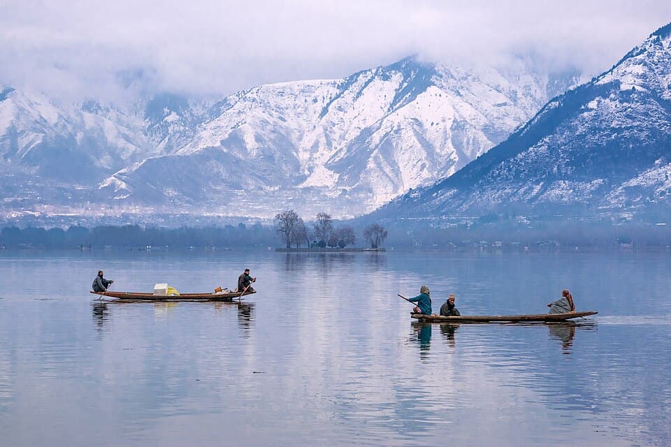
NH 44
380KM
Kashmir valley
Jammu and Kashmir, day rides from Srinagar to Gulmarg, Pahalgam and Sonamarg
- Highest point
- 8,960 ft
- Usually open
- All year; snow chains needed for Gulmarg in winter
- No fuel for
- 103 km
No rider has checked these facts yet
Each one shows where it came from and when. Ridden it? Tap “Still true” on what you saw, or “This has changed”. How far to trust it
Before you leave
On this page
Fuel53 pumps · longest gap 103 kmRules for motorcyclesPermits, rules for bikes, timings · 4 factsAltitude and night halts6 haltsTrouble on the road4 warnings · from published guides · 5 photosMechanics and puncture repair12 shops · from a public mapStays20 places · from a public mapPacking listBy monthVideos5 rider videos
Fuel
53 pumpsSrinagar0 kmSonamarg380 km103 km · no pumpPahalgam181 kmSrinagar284 km
From the open map, not yet checked
All 53 pumps were read from OpenStreetMap on 28 September 2026. No rider has confirmed any of them yet.
6 km from Srinagar.
7 km from Srinagar, 1 km off the road.
10 km from Srinagar.
Indian Oil. 15 km from Srinagar.
15 km from Srinagar.
Bharat Petroleum. 23 km from Srinagar.
23 km from Srinagar.
Show 45 more pumps
27 km from Srinagar.
31 km from Srinagar.
65 km from Srinagar.
65 km from Srinagar.
73 km from Srinagar.
80 km from Srinagar.
HP. 88 km from Srinagar.
HP. 92 km from Srinagar.
94 km from Srinagar.
95 km from Srinagar.
100 km from Srinagar.
100 km from Srinagar, 1 km off the road.
101 km from Srinagar.
101 km from Srinagar.
101 km from Srinagar.
101 km from Srinagar.
104 km from Srinagar.
Bharat Petroleum. 104 km from Srinagar.
104 km from Srinagar.
105 km from Srinagar.
105 km from Srinagar.
Bharat Petroleum. 105 km from Srinagar.
110 km from Srinagar.
110 km from Srinagar.
112 km from Srinagar.
119 km from Srinagar.
129 km from Srinagar.
129 km from Srinagar, 1 km off the road.
134 km from Srinagar.
152 km from Srinagar.
Fuel station, near Pahalgam
Last fuel for 103 km181 km from Srinagar.
Petrol pump, near Srinagar
First fuel after the gap284 km from Srinagar.
HP. 288 km from Srinagar.
Indian Oil. 294 km from Srinagar.
Indian Oil. 297 km from Srinagar.
297 km from Srinagar.
301 km from Srinagar.
302 km from Srinagar.
302 km from Srinagar.
306 km from Srinagar.
Indian Oil. 307 km from Srinagar.
309 km from Srinagar, 1 km off the road.
313 km from Srinagar.
315 km from Srinagar.
331 km from Srinagar.
Cash: ATMs and banks
10 halts| Halt | ATMs | Banks |
|---|---|---|
| TangmargHDFC Bank, ICICI Bank, J&K Bank, Punjab National Bank | 0 | 4 |
| GulmargATM, Bank, EBU, J&K Bank, J&K Bank - ATM, Jammu and Kashmir Bank | 4 | 5 |
| Between Gulmarg and SrinagarAxis Bank, State Bank of India Magam Budgam Branch | 1 | 1 |
| Between Srinagar and AnantnagAxis Bank, HDFC Bank, J&K Bank - ATM, J&K Bank - CRM | 2 | 3 |
| AnantnagAxis Bank, Axis Bank Branch, Bank, Canara Bank, Central Bank of India, HDFC Bank | 7 | 22 |
| PahalgamCentral Cooperative Bank-Pahalgam, HDFC Bank ATM, J&K Bank, J&K Bank - ATM | 2 | 2 |
| Between Pahalgam and SrinagarAxis Bank ATM, Axis Bank Branch, HDFC Bank ATM, J&K Bank - ATM, J&K Bank - CRM, J&K Bank - Extended Counter | 6 | 3 |
| SrinagarATM, Axis Bank, Axis Bank ATM, Axis Bank Branch, Bank, Bank of Baroda | 41 | 77 |
| Between Srinagar and SonamargATM, EBU, HDFC Bank, J&K Bank, J&K Bank - ATM, J&K Bank - CRM | 4 | 6 |
| SonamargATM, Bank, J&K Bank, J&K Bank - Small Business Unit | 2 | 3 |
Listed on a public map (Overture Maps). An ATM on the map can be empty or out of order, and no rider has confirmed these yet.
Rules for motorcycles
4 factsMostly reopened: spots shut after the April 2025 Pahalgam attack reopened in phases, but Baisaran was still closed in August 2026. No published order found; check each place.
No government order found · from greaterkashmir.com · dated 7 August 2026 · read 17 October 2026
During the Amarnath pilgrimage, tourist vehicles may not leave Sonamarg for Srinagar after 16:00 or travel between Srinagar and Gulmarg after 17:00. Two-wheelers are not mentioned.
From kashmirlife.net · dated 30 June 2026 · read 28 September 2026
In snow and ice every vehicle on the climb must carry chains and heavy vehicles are barred. The order has no separate line for two-wheelers.
From kashmirobserver.net · dated 16 January 2026 · read 28 September 2026
The road onward from Sonamarg has daily cut-off times set by order and published each evening. In March 2026 motorcyclists were told not to travel on it.
From jkadworld.com · dated 27 September 2026 · read 28 September 2026
Trouble on the road
4 warningsFrom published guides, not from riders
Each warning names the months it applies to. None has been seen by a rider this season unless it says so.
The uphill stretch from Tangmarg runs through forest and ices over; vehicles without chains are turned back.
From kashmirobserver.net · dated 16 January 2026 · read 28 September 2026
From 2 July to 28 August 2026 pilgrim convoys used the Pahalgam and Sonamarg roads and tourist traffic was stopped early each afternoon.
From kashmirlife.net · dated 30 June 2026 · read 28 September 2026
Collapses in May and June 2024 killed tourists and workers.
From en.wikipedia.org · read 28 September 2026
A blogger reports that only postpaid connections from outside work in Jammu and Kashmir and in Ladakh; no official source was found.
From discoverwithdheeraj.com · dated 14 August 2026 · read 28 September 2026
Recent photos near the road
5 photos


From Wikimedia Commons, the newest dated photo near each pass and high halt. A photo shows the road on the day it was taken, not today.
Mechanics
12 shopsNot listed: Srinagar (38 shops on the map). This list is for the halts between, where repair shops are few.
Motorcycle repair
From the open map · dated 22 October 2026 · read 8 November 2026
Motorcycle repair
From the open map · dated 22 October 2026 · read 8 November 2026
Showroom and service centre
From the open map · dated 22 October 2026 · read 8 November 2026
Tyres and punctures
From the open map · dated 22 October 2026 · read 8 November 2026
Tyres and punctures
From the open map · dated 22 October 2026 · read 8 November 2026
Showroom and service centre
From the open map · dated 22 October 2026 · read 8 November 2026
Showroom and service centre
From the open map · dated 22 October 2026 · read 8 November 2026
Vehicle repair
From the open map · dated 22 October 2026 · read 8 November 2026
Tyres and punctures
From the open map · dated 22 October 2026 · read 8 November 2026
Tyres and punctures
From the open map · dated 22 October 2026 · read 8 November 2026
Showroom and service centre
From the open map · dated 22 October 2026 · read 8 November 2026
Vehicle repair
From the open map · dated 22 October 2026 · read 8 November 2026
Stays
20 placesNot listed: Srinagar (755 places on the map), Pahalgam (216 places on the map), Gulmarg (67 places on the map), Sonamarg (48 places on the map). This list is for the halts between, where rooms are few.
Resort
From the open map · dated 22 October 2026 · read 8 November 2026
Hotel
From the open map · dated 22 October 2026 · read 8 November 2026
Hotel
From the open map · dated 22 October 2026 · read 8 November 2026
Hotel, 2.8 km off the road
From the open map · dated 22 October 2026 · read 8 November 2026
Hotel
From the open map · dated 22 October 2026 · read 8 November 2026
Lodging
From the open map · dated 22 October 2026 · read 8 November 2026
Hostel
From the open map · dated 22 October 2026 · read 8 November 2026
Guest house
From the open map · dated 22 October 2026 · read 8 November 2026
Homestay
From the open map · dated 22 October 2026 · read 8 November 2026
Hotel
From the open map · dated 22 October 2026 · read 8 November 2026
Resort
From the open map · dated 22 October 2026 · read 8 November 2026
Resort
From the open map · dated 22 October 2026 · read 8 November 2026
Resort
From the open map · dated 22 October 2026 · read 8 November 2026
Hotel
From the open map · dated 22 October 2026 · read 8 November 2026
Hotel
From the open map · dated 22 October 2026 · read 8 November 2026
Cottage
From the open map · dated 22 October 2026 · read 8 November 2026
Resort
From the open map · dated 22 October 2026 · read 8 November 2026
Lodging
From the open map · dated 22 October 2026 · read 8 November 2026
Resort
From the open map · dated 22 October 2026 · read 8 November 2026
Lodging
From the open map · dated 22 October 2026 · read 8 November 2026
Videos
5 rider videosWatch the date, not the view
Each video shows the road as it was that month. They play on YouTube, under the maker’s own channel.
Srinagar to Pahalgam
99 km

Tangmarg to Gulmarg
12 km
Srinagar to Sonamarg
80 km
Srinagar to Gulmarg
52 km
Nearby routes
Ridden Kashmir valley?
A trip report takes about three minutes. It fills in mobile network, real riding hours, bikes riders took and what the trip cost for the next rider. Or tap “Still true” on any fact you saw yourself.
Send a trip report